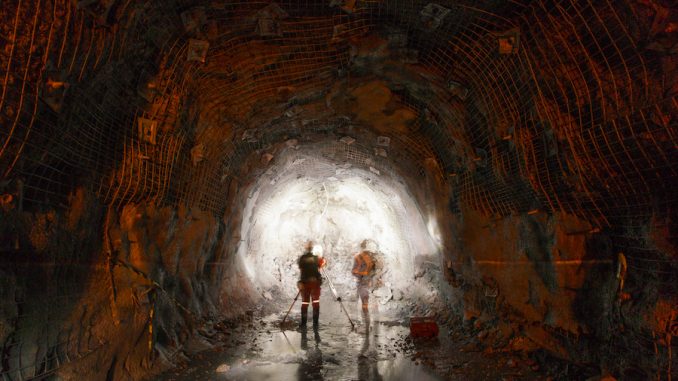
In the first article in the Abandoned Mines series, we talked about the dangers and damage abandoned underground mines can cause. We also provided sources for the development of an initial inventory of these mines. In this article, we outline how to prepare for and complete an initial site investigation. Although there are many dangers that an underground abandoned mine may pose, the focus of this series is abandoned mines under roadways.
Initial Abandoned Mine Inventory
To prioritize your site visits, you will be working off your initial abandoned mine inventory list. The following information should have been captured in a spreadsheet or database:
- County, route, and section.
- Site length and lane miles.
- Site evaluation status.
- Risk assessment rating (e.g., site group and site evaluation rating).
- DNR (Department of Natural Resources) and DGS (Dept. of Geological Survey) mine map index number.
- S. Geological Survey topographic quadrangle name.
- GPS and state plane coordinates.
- Site elevation.
- Township and section.
- Comments such as mine name, field report number, etc.
Initial Site Investigation
There are several advantages to performing an initial site investigation including:
- Familiarizes personnel with abandoned underground mine inventory locations.
- Provides field verification of documented site characteristics.
- Produces a permanent record that is used for both the initial and detailed site evaluation.
- Provides information needed to add or eliminate sites from the initial inventory.
The following information must be gathered and reviewed in preparation for the initial site visits:
- Maps for each individual abandoned underground mine to determine roadway locations.
- Corresponding roadway maps.
- Measured geologic sections and geologic structure maps.
- Historical information on subsidence events that occurred near individual roadway sites.
- Roadway and right of way plans.
- Subsurface investigations.
- Centerline survey plat
- County maintenance records.
Where both mine maps and roadway drawings are available, a preliminary composite plan view should be manually compiled by overlaying the mine map on the roadway drawings.
Individual Site Visits
You have two goals in mind when you visit an abandoned underground mine site: 1. To gather field data and 2. To determine if the site can be eliminated from the initial site inventory. Obviously, a site will only be removed if it can be documented that it is not a current or future threat to public safety.
Site Visit Prioritization
Site visits should be prioritized in order of roadway classification:
- National Highway System (NHS) Interstate.
- NHS other than an Interstate.
- Arterial (high capacity urban road).
- Collector (low- to moderate-capacity road).
Site Visit Preparation
The district engineer should prepare for the initial investigation by gathering and reviewing all pertinent information, preparing the preliminary composite overlay plan view, notifying the county manager, and suggesting the needed equipment and field gear. In addition to inviting the county manager to participate in the site visit, the district engineer should find out if records of atypical maintenance or construction at the site are available.
Equipment
Examples of equipment that may be needed to perform a site visit include:
- Shovel permanent marker DMI equipment
- Tape hammer measuring wheel
- Camera rock hammer climbing rope
- Altimeter (+/- 5 ft.) level rod, telescoping calculator
- Soil probe sounding rope (cord with scale weight)
- Handheld GPS unit
Initial Site Investigation
You are now prepared to physically visit the site and complete the initial site investigation. You will perform several field observational tasks as part of your investigation. The information you gather is used to perform the initial and detailed site evaluations.
Mining and Geologic Information
Mark the features you observe in some way, such as using paint or ribbon. Describe the site setting generally and record any unique site features. Confirm this information against a field data sheet, if any. Specific information to record includes:
- Number of subsidences.
- Maximum mined interval thickness.
- Mine opening information, such as number of openings, opening location(s), and how the openings are closed.
- Mine opening cribbing, such as timber or brick.
Record any additional information that may be provided to you by local contacts. For example, secondary mining or problems reported during mining activities when the site was active.
Roadway Information
Document whether there are any structures on the site. If so, note the structure type and the material it is made out of, such as brick or concrete. Other roadway information to document includes:
- Posted speed limit(s) within the site’s boundaries.
- Pavement type.
- Any evidence that indicates that the mine is not located under the roadway.
Sketches
Hand sketch the following:
- Site limits. (Sketch these directly on the map or plans.)
- Topographic anomalies.
- All recorded features.
Photographs
Take photographs of all the relevant features of the site along with notes that describe the camera angle used. Take pictures of significant features at several angles.
For a complete list of information gathering activities to perform during the initial site investigation, refer to section 3.3.3.1.2 of the U.S. Department of Transportation’s Manual for Abandoned Underground Mine Inventory and Risk Assessment Manual
Next Up
The process of identifying and evaluating underground abandoned mines is an arduous task. The resulting risk assessment and mitigation planning is critical to protecting the traveling public. We will discuss initial site evaluation and risk assessment in the next article in our Abandoned Underground Mines series.
What information should be included in the initial abandoned mine inventory list?
The initial abandoned mine inventory list should include details such as county, route, section, site length, risk assessment rating, GPS coordinates, and more.
How are site visits prioritized in the context of abandoned underground mine assessments?
Site visits are prioritized based on roadway classification, ranging from the National Highway System (Interstate) to Collector roads, ensuring a systematic approach to assessments.


